A Spatiotemporal Interface Integrating ML Chemical Classification and Orbital Dynamics for Saturn Ring-Plane Dust from the NASA Cassini Mission
Jump to DiscussionLinks
Sign in to access the Paper PDF.
Abstract
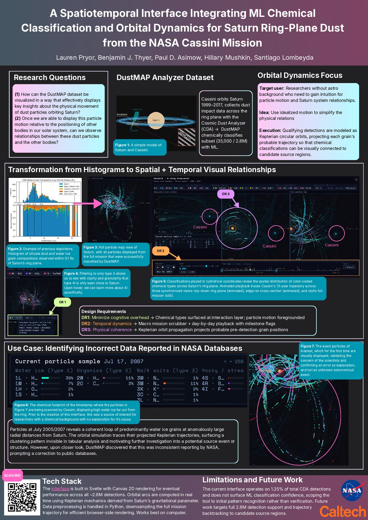
From 1999 to 2017, the Cosmic Dust Analyzer (CDA) aboard NASA’s Cassini spacecraft recorded 2.8 million hypervelocity dust impacts within Saturn’s E-ring and outer ring planes [ 2]. These im- pacts yielded time-of-flight (TOF) mass spectra containing chemical composition data. Historically, extracting chemical structural pat- terns required a manual calibration process wherein domain experts visually mapped raw time-of-flight peaks to chemical masses via the standard t = α√m + t0 relationship. This manual bottleneck limited comprehensive chemical inventories to isolated, small-scale subsets of the data. The DustMAP (Dust Mass Analysis Pipeline) was developed to overcome this. With convolutional neural networks (CNNs) and random forest classifiers, DustMAP automated peak detection and calibration optimization via weighted least squares to favor highly precise lower-mass correlations. This machine learning advance- ment has currently produced an analytical catalog of just over 35,000 highly precise, mass-calibrated spectra sorted into 14 distinct chemi- cal sub-types and 4 overarching molecular families (water ice, or- ganics, sodium/salt, and rocky/stream particles) [1]. However, presenting this data solely as a static, multi-dimensional tabular matrix can have a context barrier. Planetary science inves- tigations depend on knowing where and when specific chemical species exist in relation to Saturn’s dynamic environment and active moons (e.g., Enceladus). We present an interactive web interface built on Svelte and Canvas 2D that integrates these ML chemical classifications with real-time Keplerian orbital dynamics projections. Our interface provides synchronous cross-sectional, top-down or- bital, and global particle map views, coupled with dynamic temporal filtering.We validate this approach through a use case in which the interface surfaced an anomalous spatial cluster, leading to the discov- ery of a historical reporting mismatch in legacy NASA databases.